|
Fast-forward three months. Somehow, it would have
been fitting to do our home state highpoint first, but as these things
evolve, Taum Sauk would be our second highpoint.
Nathan (six-going-on-seven) and I hooked up with a Sierra Club group
hiking to the top of Taum Sauk Mountain, the highest point (1,772.68 feet)
in Missouri. The high point is now in a state park approachable by road,
with a parking lot and all of a quarter-mile paved path to the high-point
marker. However, not wishing to make it too easy on ourselves, we chose
the bipedal approach, instead.
The hike started at the Claybaugh Creek trailhead on Highway 21, about a
mile south of Highway CC which leads into the park. From there it is about
6 miles and 700 net vertical feet to the summit of Taum Sauk. The trail
winds through mixed hardwood forests and up to about 1,600 feet on the
adjacent Russell Mountain before dropping down about 250 feet to cross the
valley between Russell and Taum Sauk. (Why the trail doesn't skirt the
nearly-level ridge is a puzzlement...) That gives a total of about 1,200
feet of gross vertical motion, following the old backpacker's rule "that
which goes down must come back up."
The weather was delightful, starting out in the low 50's and warming well
into the 60's by noon. The leaves had just started to turn, with sumac and
dogwood showing some color here and there. Early frosts the preceding
mornings had knocked down the ticks and chiggers, which made for more
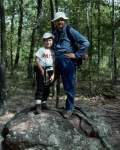
pleasant hiking. We stopped on a rocky outcrop on Russell Mountain about
halfway for lunch, where Nathan had a chance to chase a late-season skink
before it skittered off into the undergrowth. By the time we had regained
the altitude lost crossing the creek, Nathan was getting a bit tired, but
the Sierra Club "trailer" was understanding even though we fell fairly far
behind the rest of the group. Once again, Nathan held up his tradition as
the Energizer Bunny...he just keeps going and going and going...
|
|
The top of Taum Sauk is nearly dead flat for the last half-mile of the trail,
with perhaps a total of 20 feet change in altitude. As we approached the
summit, the trail widened out with greater use and we soon came to the
paved path leading to the summit and parking lot.
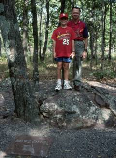
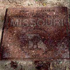
The Missouri highpoint is marked by a granite plaque proclaiming its altitude
and status.
After signing the summit log and taking the requisite summit photos, we headed
back to the cars which the drivers had ferried up before starting the hike.
Two-and-a-half hours later, we picked up a pizza for dinner and arrived back
home...not a bad day's outing!
|
|

