|
Arizona's Highpoint:
|
|
Saturday/Sunday, September 6-7, 2008 |

|
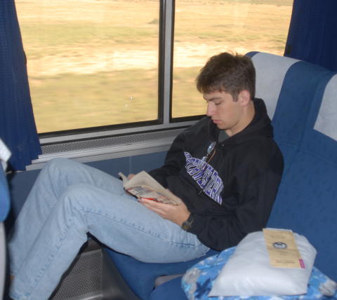
Between finalizing Nathan's decision on colleges (Northwestern) and a second trip to Philmont in 2007, we hadn't been able to pick up our highpointing pursuits since Mauna Kea in 2006. In 2008, the Highpointers Club convention was scheduled for early September in Flagstaff, Arizona. Having been stormed off Humphreys Peak the first time we tried it, we decided that a trip out to the convention and a couple more shots at a good weather window sounded like the perfect way to end the summer. Fortunately, on a quarter-system schedule, Nathan didn't have to be back to Northwestern until late September and we opted for the leisurely Amtrak connection out to Flagstaff. We had used Amtrak on our first Philmont trek in 2005 and decided that taking a relaxing day each way wasn't a bad idea. The train was about 30 minutes late at our local Amtrak station in Kirkwood and fell a bit further behind as we made our way across Missouri for our connection in Kansas Ciry. No worries, however, as we had several hours to spare anyway. |
|
The Southwest Chief pulled out right on time and we settled in for the night. Amtrak coach seats are adequate for one night, with flip-up footrests and decent recline. The train wasn't crowded, so we each had a double seat to ourselves. Sleeping through Kansas isn't a bad idea and we woke up on the plains of eastern Colorado at breakfast time. |
|
|
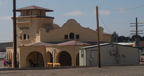
Arriving in Raton, NM, we felt on familiar ground, that having been our destination when we rode the train out to Philmont Scout Ranch in 2005. West of Raton, the countryside gets hillier and we started seeing puffs of clouds that would be blowing up into afternoon thunderstorms. Most of what cropped up didn't seem to be threatening until close to noon, so that bodes well for Humphreys Peak tomorrow. |
|
Monday, September 8, 2008 |
|
We got up at 3:30 a.m., grabbed our oatmeal bars for breakfast, stopped briefly at a gas station convenience store for coffee and juice and headed up to the Humphreys Peak trailhead at the Arizona Snow Bowl. There was an early morning light overcast but it started dissipating about the time we hit the trail at 5:50 a.m. As the sun started to rise, we could begin to see more of the surrounding countryside, although the western slopes of Humphreys Peak were still shrouded in shadow. The remnant overnight clouds continued to dissipate, promising decent weather for at least a little while. |
|
|
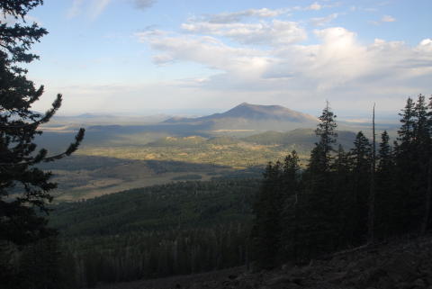
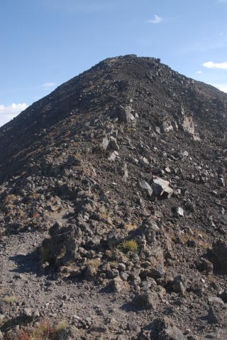
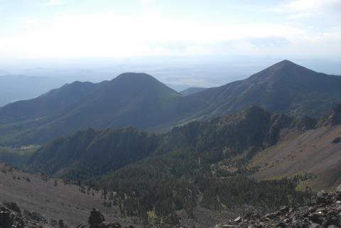
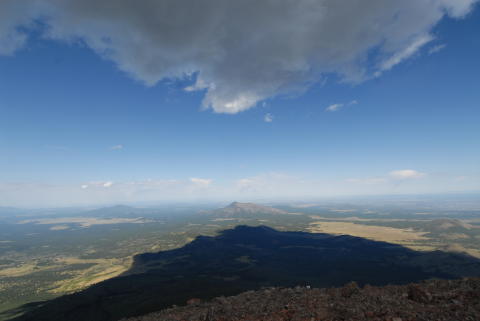
Once we reached the Humphreys/Agassiz saddle, we could see our goal off a mile or so in the distance. The true summit is the hump farthest to the right on the ridgeline in this photo. Although the GPS says you're only about 0.7 miles from the summit, the trail wanders a good mile-and-a-quarter along and just below the ridgeline past what seems an interminable series of three false summits. Most of the time, there is an easily-discerned trail but there are a few spots of confusion and a moderate amount of boulder-hopping here and there. At this point, the weather seemed to be cooperating nicely...nearly clear blue skies with only a hint of high clouds. |
|
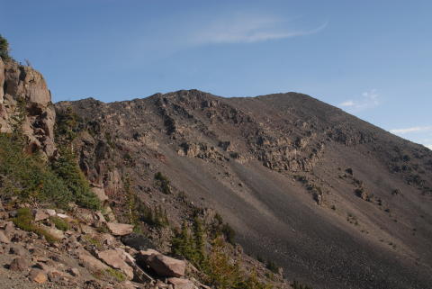
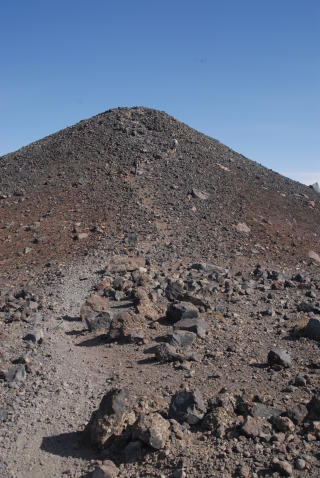
Did I mention the false summits? Well, look at the shot to the right, then the true summit a bit later in the report. So tempting and yet so frustrating when you find the trail bending around the false summit and continuing on to the north. The fact that there are three of these gems merely adds to the climber's pleasure. At least the views off to the east make up for some of the frustration in the long ridge traverse. |
|
|
|
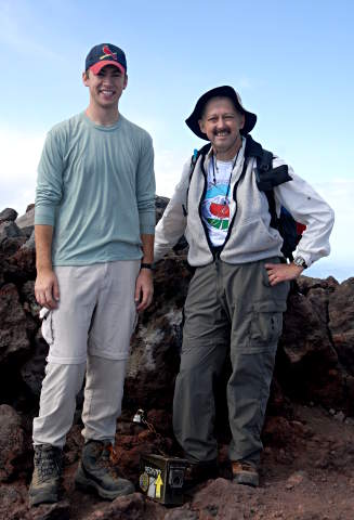
After traipsing around and over the false summits, we did eventually reach the approach to the true summit. A brother and sister had passed us shortly before while we stopped to catch our breath and are visible halfway up the final scramble to the summit proper. These last few feet are about the steepest part of the climb but even so, no appreciable exposure and only a moderate amount of rock-hopping as opposed to trail walking. At this point, seeing that the skies were still blue was a most welcome sight. Our confidence was certainly buoyed for the last push up to the summit. A few minutes' more scrambling and we were at the highpoint of Arizona, 35° 20.786'N, 111° 40.677'W. We reached the summit at 9:30, just over 3-1/2 hours after leaving the trailhead. Not a speed record by any means but for 4.8 miles and about 3,000' of gain, with minimal acclimation, we were quite happy. |
|
We traded summit photo duties with the brother/sister duo who had just preceded us to the summit. The view from the summit is spectacular, but what is that ominous shadow to the west and why is there suddenly a dark cloud right overhead? It must be time to head down! I did spend enough time to shoot the source images for my traditional summit panorama. (You will need a Java-enabled browser to view the small copy that pops up from that link, or have loaded Quicktime to view the larger copy linked to from that page.) |
|
|
|
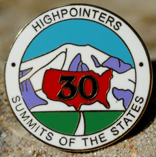
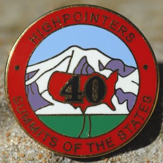
With the clouds overhead building rapidly, we left the summit at 10:00 a.m. The first rumbles of thunder behind us began by 10:15, so we were not inclined to dally long on that mile or so of summit ridge. We did run into several other groups of hikers still headed up but were not any more successful than usual at convincing them that they were running a serious risk of becoming human lightning rods if they continued upwards. Indeed, a couple of college-aged guys even commented as they hiked past in shorts and t-shirts that they might have been better off if they had thought to bring a jacket with them. As we continued down the ridge, we were pelted by graupel, those styrofoam-like snow pellets. We encountered one climber hunkered down along the ridge saying that he was going to wait a while and see if it cleared off so he could continue. No such luck...between graupel, rain and lightning flashing behind us, we continued down and into the trees before even thinking about stopping for a break. By the time we were off the ridge and well below timberline, the skies opened up even more. Our planned snack stop disappeared in the interest of getting as low as possible as quickly as possible. By the time we got back to the trailhead at the Arizona Snowbowl, the storms were dropping moderate to heavy rain and lightning was occasionally striking trees even at lower elevations. We hoped that the hikers who remained up higher on the mountain were safe! Back to the car, a bit damp but undeterred, having succeeded in our first (and primary) goal for the trip, we headed back into Flagstaff for a well-earned pizza lunch. Nathan's highpoint count has now reached 40 and mine, 42. Arizona was the fifth for each of us in the Western region, so we now qualified for both our 30-highpoint and 40-highpoint pins. (The 30 pin requires at least five from each of the four regions. The 40 pin has been recently reaffirmed as "any 40" by the Highpointers Club Board of Directors.) |
|
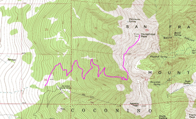
The map above is a section of the Humphreys Peak 7.5-minute USGS quad with the trail as recorded by my GPS highlighted. |
|
Tuesday - Friday, September 9-12, 2008 |
|
|
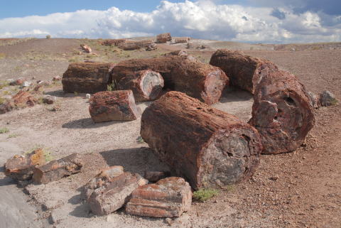
After our successful summit bid on Monday, we chose to sleep in a bit on Tuesday and catch up from traveling and getting up early on Monday. After breakfast, we drove east along I-40 to the Petrified Forest National Monument and spent much of the day meandering around and dodging raindrops and hailstones as the thunderstorms blew up quickly. For more photos of the Petrified Forest, please refer to my separate photo album. |
|
Wednesday marked the opening of the Highpointers Club convention, the second reason for our trip out to Flagstaff. We registered at the Convention and checked in with Jean Trousdale at the "Merc" to buy our 30 and 40 highpoint pins. We spent the rest of the afternoon renewing old friendships and meeting new highpointers before and at the Club ice cream social. |
|
|
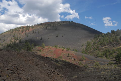
Thursday, we chose to drive northeast of Flagstaff to Sunset Crater National Monument. This is part of the most-recent volcanic activity in the Flagstaff area and includes cinder cones like Sunset Crater as well as lava flows, spatter cones and other volcanic features. The eponymous crater is so named because of the red volcanic ash that makes up part of the cone. Thursday evening marked another social gathering of the "Liar's Club" with highpointing tales shared over beer and wine. |
|
|
Friday, we decided to join Dave Covill and see the Walnut Canyon National Monument (do you sense a theme here?). Dave's plans included a visit to the ruins in the canyon preceded by a bit of exploration at the far corner of the National Monument to find the highpoint of the Monument. Unfortunately, the meandering along Forest Service roads and bushwhacking necessary to find the highpoint ate up the available time and we never got to the ruins in the canyon. Something for another trip through this part of Arizona. Friday night was the traditional Club banquet, replete with door prizes (Nathan and I collected some hiking staff medallions of highpoints we have done), recognition of 48 and 50 highpoint completers and the vote on the location of the 2010 Convention. There was only one state nominated in the Southern region, so it was a unanimous vote for Mississippi (Woodall Mountain) in 2010. After dinner, we had to head back to the hotel to pack up for our early-morning departure from the Amtrak station. |
|
Saturday/Sunday, September 13-14, 2008 |
|
Up at 3:30 a.m., we found to our dismay that we could have slept a bit later since the 5:11 a.m. eastbound Southwest Chief was running about an hour late. We commiserated with our fellow train travelers as we waited for the train, which ended up leaving about 6:15. Once again, we took the opportunity to enjoy the scenery rolling past the train windows. When you have the time to spend, it's a great way to travel. The overnight leg on the Southwest Chief from Flagstaff to Kansas City went uneventfully. We even arrived in Kansas City about 30 minutes early, which gave us the chance to connect with the morning Ann Rutledge run to St. Louis instead of having to wait from 7:30 a.m. until the 4:00 p.m. train. Hey, what's this? We had gotten just past Independence, MO, a little over a half-hour out of Kansas City and the train stops. The conductor comes on the intercom and announces that there is a flooded tunnel and multiple trees down across the tracks all across Missouri and we're backing up all the way to Kansas City. 45 minutes later, we arrived back at the Kansas City Union Station, detrained and waited a bit over an hour for busses to to take us across the state. Thanks a lot, Hurricane Ike! Travel is always an adventure. The good news is that we still got home about 3:30 p.m., well ahead of when we had originally planned on getting back to the Kirkwood station. The even better news is that when we did get back to Kirkwood, the Amtrak station volunteer said that the afternoon train that we had planned to take had been cancelled outright because of the flooding and Amtrak wasn't even providing busses for the afternoon passengers. That would have been an even bigger mess, trying to figure out how to get home with the afternoon train cancelled. |
|
Respectfully submitted by
Alan Ritter, September, 2008 |